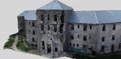
Berengaria Hotel in Prodromos 3D Laser Scanning
High up in the Troodos mountains, in Prodromos village in Limassol, stands the Vereggaria hotel at a height of about 1700m. The hotel took its name from Queen Berengaria, the wife of King Richard the Lionheart, The hotel was once claimed to be one of the most wonderful Cypriot Resorts of the 20th century and it is it was also known as “the hotel of kings” because it has attracted many renowned guests of royalty, fame and riches, inter alla Winston Churchill, the Duke of Marlborough, the king of Egypt Pharouk and the president of Israel Ezer Vaisman.
The hotel was build and opened by Mr. Kokkalos in 1931, and closed towards the late 70s-early 80s, due to poor hygiene and financial problems. According to legends, the hotel is haunted and there are a few ghost stories connected to the hotel. After Bereggaria’s closure, plenty of efforts have been made to restore the hotel, (signifying preservation of ‘cultural heritage’), but time after time any effort seemed to disappear.
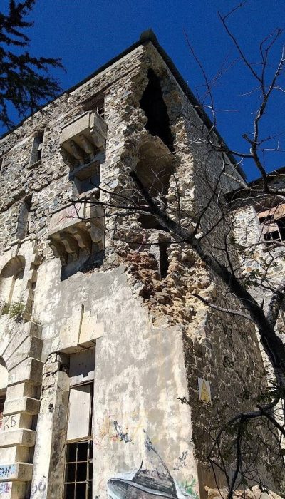
To date, the historical Bereggaria hotel remains abandoned with “broken windows, a sagging roof, and splintering walls and it is in need of extreme repair.
The hotel has recently changed owner, and now, an attempt to bring the hotel back to life is currently in progress and this would indicate the preservation of our cultural heritage. In order to renovate and bring new life to this historic building, an accurate documentation of the existing condition of the building is critical.
Knowledge of the position, size, shape and identity of the components of the historic building is a fundamental part of a restoration project. A detailed 3D record prior to any intervention on the building is needed for assisting in the conservation and refurbishment, as well as for structural and condition monitoring, such as observing changes in response to subsidence, erosion and vandalism.
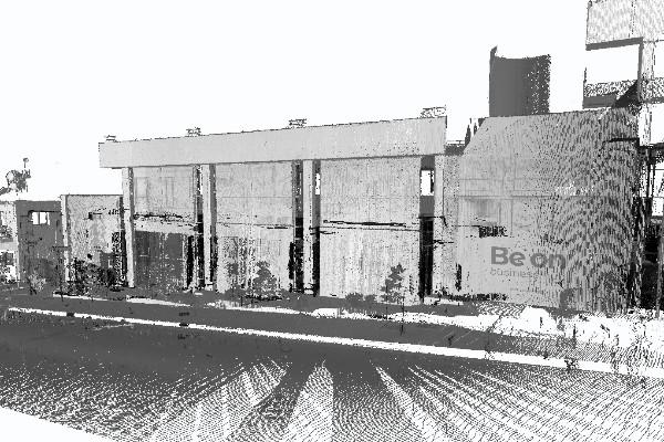
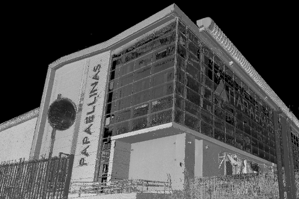
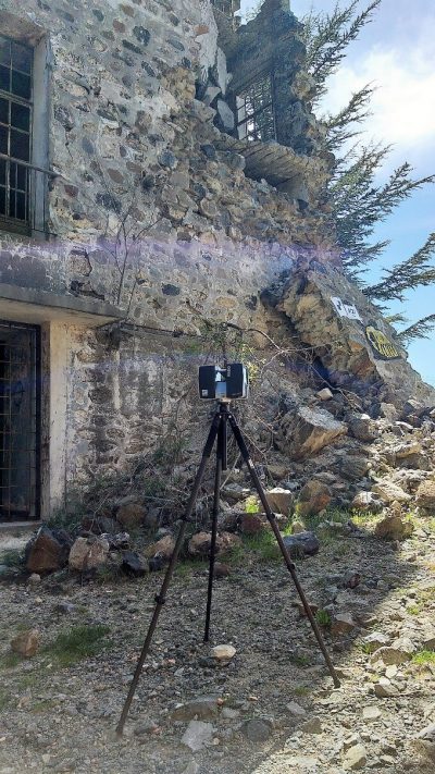
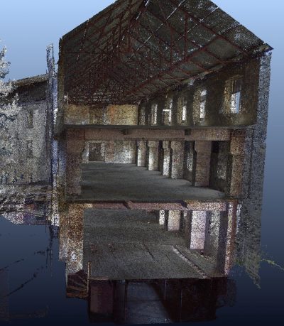
Geoimaging LTD with an extensive experience and a lot of know-how in documenting existing buildings for restoration and preservation purposes, was assigned to undertake an accurate surveying of the building and record its exiting condition. Our company, which invests in laser scanning technology for more than fifteen years, used 3D laser scanning for historic preservation to create a digital point cloud and to record every detail of this massive three-storey building in efforts to preserve its history. Laser scanning is a fast and automatic acquisition technique of this information using laser light for measuring, without any contact. More specifically, laser scanner collects 3D coordinates of points on surfaces in a dense regular pattern, also called 3D point cloud. The result and benefit of this technology is in producing a better survey on time with overall lower cost.
Laser scanning was chosen as the suitable method for this project, since it is the most efficient way to record the hotel internally and externally. On the contrary, conventional surveying would be an incredibly time-consuming with huge potential for inaccuracies. If a total station and hand measurements were used, this would have required several weeks on site and accuracy for the more inaccessible areas would have been compromised. On the contrast, 3D terrestrial scanning Technology has made it easier and more precise, time and work saving, but also the intricacies and details of the structure can be captured.
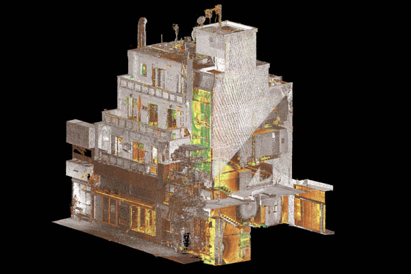
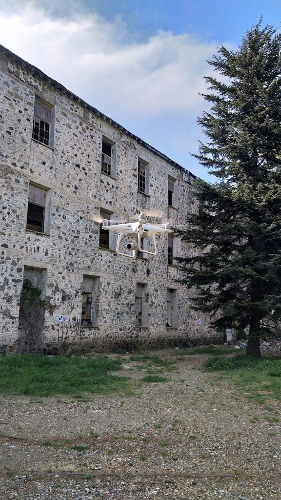
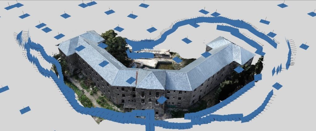
Due to the great height of the building, laser scanning measurements were combined with aerial drone footage in order to map the terrace and the higher parts of the building. By using both laser scanning and drones, the scene was documented and captured efficiently and data were merged to create a complete view of the scene memorialized in 3D, where you can revisit and analyse anytime.
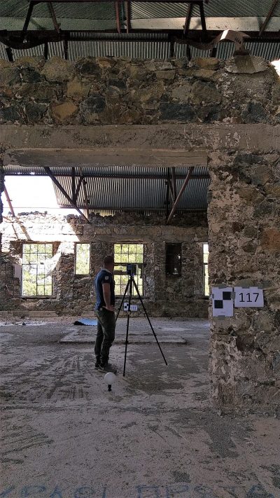
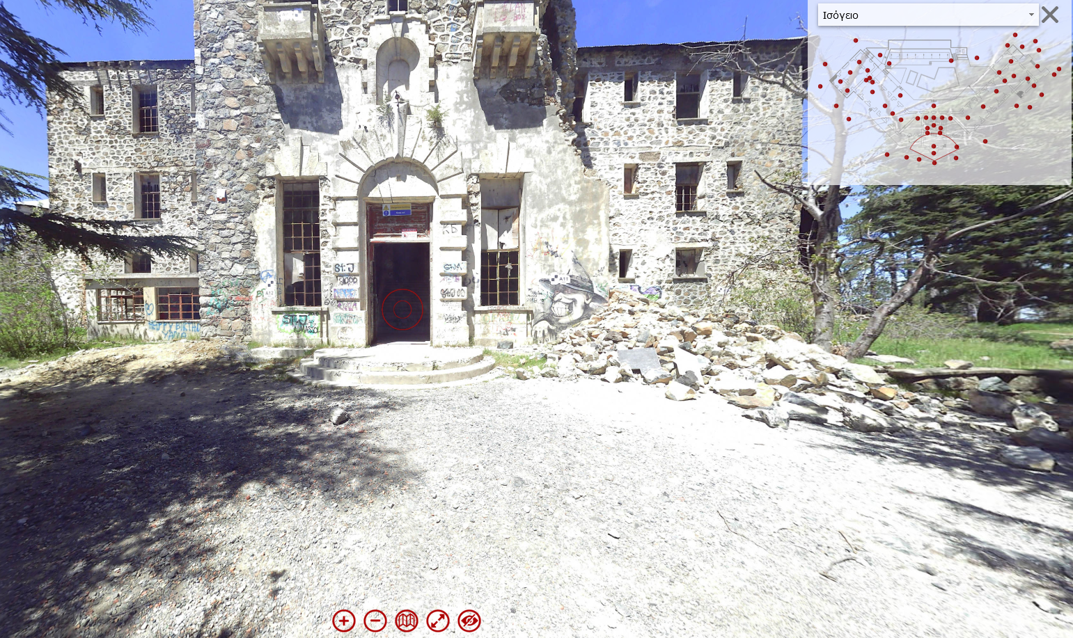
The on-site laser measurements were significant in order to draft accurate and detailed as-built floor plans. Our final deliverables were four floor plans, a 3D georeferenced point cloud and an interactive virtual touring map with 360 viewpoints, which allowed architects as well as other engineers and interior designers to plan, maintain, repair, redesign and approve with actual measurements.
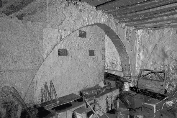
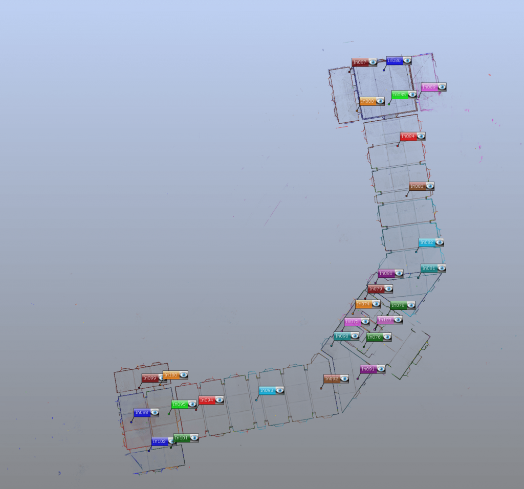
The general procedure of the scanning lasted 4 days, whereas the procedure of the aerial mapping lasted only one day. The first step for both procedures was to determine a control network to which all field data would be then georeferenced. The specification required full georeferencing to the national grid (Cyprus LTM coordinate system). This information was needed to merge the scans for the interior and exterior of the building and for the photogrammetric process of the aerial photos. Our purpose was to site control points to appear on as many scans and photos as possible to strengthen the network. Our team used both spheres and 2D A4 paper checkerboard targets fixed on walls and on floor/ground in locations specified by our surveyors. Targets had to be large enough to be visible in scannings and aerial photos. Then these targets were surveyed and their horizontal and vertical coordinates were provided by using a total station in combination with survey grade global positioning systems (GPS). Then, the scanning procedure started. To scan the entire building, a number of scans from different locations were required to ensure full coverage. 135 different scanning stations were created in total (34 scans for outdoor areas and 101 scans for indoor areas).
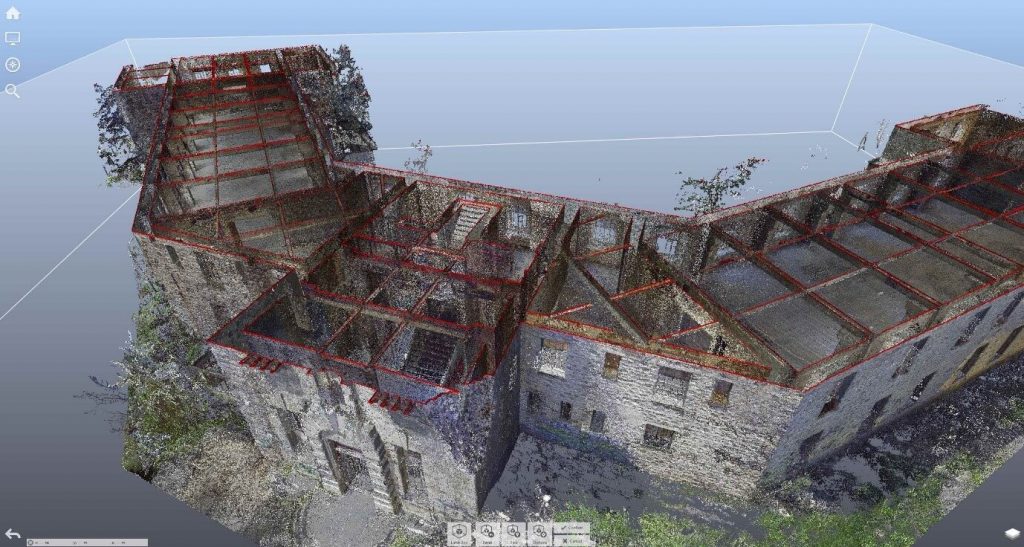
Since the scanning process ended, the next major stage was to register the scans in the office to form a merged dataset covering all the subject. In order to turn scan data into a useful product, the scans had to first be registered, through the use of survey control measurements. In this step, the multiple scannings were stitched together into an accurate georeferenced point cloud based on the measured common targets and on other discrete common 3D points. Subsequent processing steps on the point cloud to provide the deliverable products included: cleaning extraneous scan data from unwanted features, filtering, sectioning, meshing, rendering (texturing) and tracing CAD detail (vectorisation).
As regards the aerial mapping process, the first step was to schedule the flight over the site-area to capture the imagery. Our experienced personnel actually flied the drone over the property, taking a series of oblique and vertical photos with a large format aerial camera. During this process, multiple overlapping photos of the ground are captured from different angles as the aircraft flies autonomously along a flight path that we specify beforehand. This ensures we don’t miss anything and enough image overlap is achieved. After acquiring the aerial images, the data were then processed properly in the office to create a 3D model. During this process, images were aligned together based on the known ground target locations.
Since there was a good distribution of markers, both clouds from scanning and drones were combined in mm accuracy. Vectorisation plans were generated by using the final 3d georeferenced point cloud as a base for tracing features. This process was conducted directly be sectioning horizontally the point cloud on specific heights.
On the whole, 3D laser scanning and modelling is key in preserving old heritage buildings. Proactive planning with our trusted As-Buit Surveying and Drafting/Modelling team, ensures our century-old buildings are preserved for centuries more to enjoy.
Berengaria Hotel 3600 Virtual Tour
We’d love to help you with your next project!