Laser scanning and 3D documentation of two traditional buildings in Kato Lefkara
Lefkara is a traditional village in Larnaca District, Cyprus where the majority of houses are traditional and have been listed by the Department of Antiquities and the Department of Housing and Urbanism. This is the case for two old traditional houses situated in Kato Lefkara, which are now going to be restored for residential purposes.
In this kind of projects, a preliminary detailed documentation of the building as it is, is essential. Most home restorations happen to old homes that date back to before the existence of modern digital architectural drawings and BIMs. These homes’ original drawings were likely drawn by hand and most of the times original drawings have been lost. When planning a renovation project, engineers need to verify these drawings and ensure they accurately represent the current state of the home. A building restoration requires scaled plans, full elevations as well as the production of appropriate cross sections to show the building condition as it is. The drawings need to show the full level of irregularity in an historic building because rooms are seldom anywhere near square, floors are rarely level, walls never have a consistent width etc. All this information of the existing condition allows the architect as other engineers and interior designers to repair, plan and redesign.
To achieve highly-accurate and detailed drawings, the use of 3D laser scanning technology is essential since in this way engineers can measure the entire existing home with the generated 3D model very quickly. This ability allows engineers to get an accurate picture of the home compared to the existing drawings. In this way, laser scanning helps homeowners and contractors save time, money and energy by quickly producing accurate 3D models and 2D drawings of the home.
Geoimaging ltd with an extensive experience in documenting historical preserved constructions was asked to scan these houses and produce detailed 2D drawings of the house. Our company offers the best solution to achieve detailed plans and high accuracy since we are using a high-tech laser scanning technology. 3D laser scanning allows us to capture in full all the detail of existing buildings at a level of precision that is very difficult and time-consuming to accomplish using other conventional surveying methods.
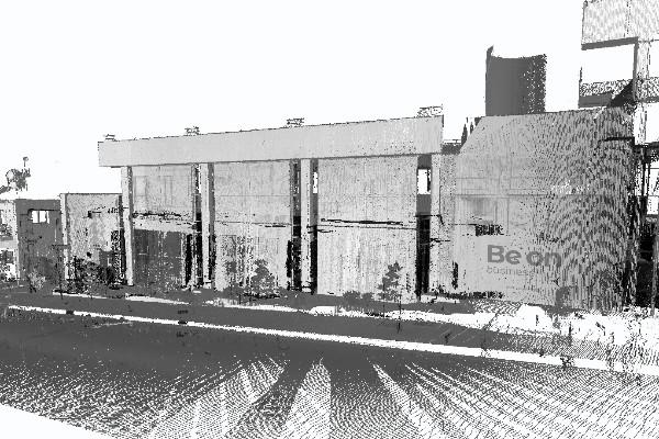
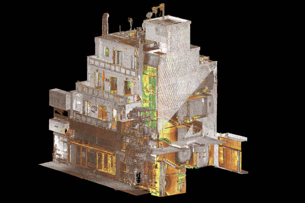
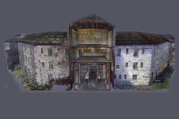
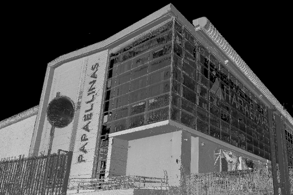
Data for elevations, plans, and cross sections for both buildings were collected by combining a 3D laser scanner, a total station and a GPS receiver. Our final deliverables were the floor plans of the building, elevations, cross sections, a 3D point-cloud model and a 360 virtual tour. All this material carrying the current condition of the buildings was then delivered to the architects to provide them all the necessary information they need to begin the restoration process.
Are you planning to restore your old historic building?
Our 3D scanning services can help you save time and money on your restoration project!